 By
By 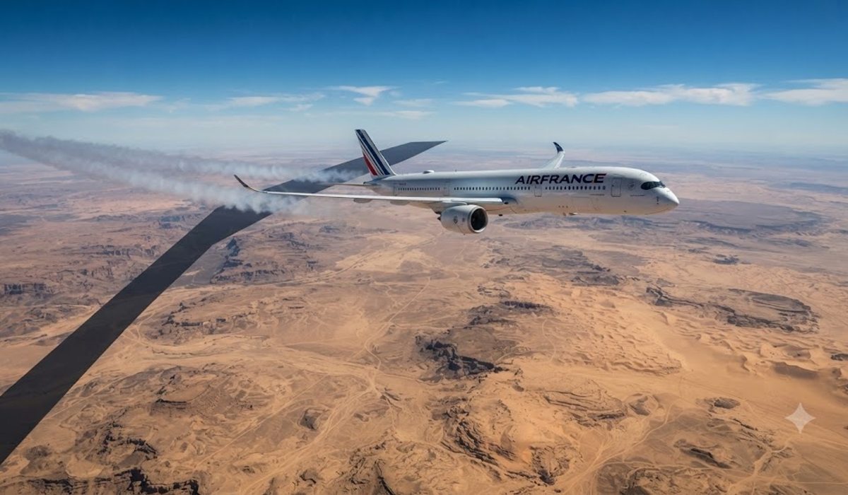
Niamey Military Coup Triggers Aviation Crisis
[Niamey, August 31, 2026] — The aviation network across Africa is facing severe operational strain as airspace restrictions in the Sahel region compel airlines to abandon established flight corridors. The current instability in Niger has fundamentally altered air traffic patterns, forcing carriers to reroute flights via the Atlantic Ocean and the Red Sea. While passengers may only notice slight changes in flight paths, the operational reality involves significant increases in fuel consumption, higher operating costs, disrupted crew scheduling, and delayed cargo shipments.
The crisis began following a military coup in Niamey, which transformed Diori Hamani International Airport (NIM) from a reliable regional transit hub into a flashpoint for West African geopolitical tension. Following the coup, military decrees suspended constitutional institutions and closed international air borders, leading to the abrupt closure of the Niamey Flight Information Region (DRRR FIR) to commercial traffic.
Although overflight access was eventually restored for many civil operators, the situation remains volatile. Nigerien authorities have implemented selective airspace prohibitions, specifically targeting aircraft registered in France or those chartered by French commercial entities. This includes the national carrier Air France, which is now barred from entering Nigerien airspace, severing primary corridors that previously linked Western Europe to Sub-Saharan Africa.
Strategic Disruption of Trans-African Corridors
The closure of the skies over Niamey has shattered the strategic equilibrium of aviation in the region. Historically, the airspace managed by Niamey offered the most efficient and direct route for long-haul flights traveling between major European hubs and economic centers in Central and Southern Africa. With the restriction of the Niamey Upper Information Region (UTA), international airlines lost their primary overland access through the African interior.
In response to the crisis, foreign ministries and civil aviation authorities issued urgent Notices to Airmen (NOTAMs). These directives instructed flight dispatchers to either avoid the DRRR FIR entirely or implement tactical rerouting. The immediate aftermath of these restrictions saw dozens of regional flights grounded and significant delays for international long-haul sectors, forcing global network planning centers to implement emergency protocols.
ASECNA Activates Emergency Traffic Contingencies
To prevent catastrophic congestion along the borders of the restricted zones, the Agency for Aerial Navigation Safety in Africa and Madagascar (ASECNA) activated formal air traffic management contingency plans. Operating under the International Civil Aviation Organization (ICAO) Annex 11 framework, ASECNA coordinated a temporary delegation of air traffic services (ATS) across Niger's upper airspace.
Procedural control was reassigned to Area Control Centres (ACCs) in Dakar (GOOO) and N’Djamena (FTTJ), which established restricted contingency routes and specific flight level corridors. While this intervention prevented total airspace collapse, the loss of direct control channels within the Niamey UTA has created a permanent bottleneck.
Under these current arrangements, operators must file flight plans that adhere strictly to designated alternative corridors. This requires maintaining mandatory cruising levels and constant Mach speed numbers to avoid traffic conflicts in sectors that lack full monitoring. Consequently, ACCs in Accra, Algiers, Bamako, Kano, Nouakchott, and Ouagadougou are absorbing unprecedented traffic volumes, which has strained regional communication infrastructure and significantly increased the workload for air traffic controllers across West Africa.
| Entity / Regulation | Operational Status | Strategic Impact on Aviation Corridors |
|---|---|---|
| Diori Hamani Intl Airport (NIM) | Restricted / Military Oversight | Primary disruption node hosting national military command |
| Niamey FIR (DRRR) | Contingency Delegation Active | ATS procedural control reassigned to Dakar and N’Djamena ACCs |
| ASECNA Directives | Targeted Overflight Bans | Prohibits French-registered aircraft and Air France charters |
| Flight Level Restrictions | FL320–FL400 Mandatory Belt | Restricts cruising altitudes over northern Mali and Niger sectors |
Analysis of the 4,000-Kilometre Sahel No-Fly Barrier
The disruption in Niamey is part of a larger, more complex pattern of instability across Northern and Central Africa. When combined with restrictions in Mali, Sudan, and Libya, the result is a contiguous "no-fly zone" spanning nearly 4,000 kilometres from the Atlantic coast to the Red Sea.
In Sudan, the HSSS FIR (Khartoum) remains closed due to intense military conflict, pushing traffic either south toward Kenya or north toward Egypt. Simultaneously, the European Union Aviation Safety Agency (EASA) continues to issue Conflict Zone Information Bulletins (CZIBs) that restrict civil operations within Libyan airspace (HLLL FIR).
This unbroken band of restricted airspace acts as a geographic wall, splitting trans-African aviation into two isolated halves. Dispatchers no longer have the flexibility to penetrate the continental interior, leaving them with only two options: circumnavigating the continent via Atlantic maritime tracks to the west or navigating the congested choke points of the Red Sea to the east. This lack of flexibility turns standard long-haul flights into high-risk logistical operations that are highly susceptible to weather disruptions.
Operational Risks Within the Alliance of Sahel States (AES)
Political tensions within the Alliance of Sahel States (AES)—consisting of Niger, Mali, and Burkina Faso—have further complicated airspace management. In Mali, ASECNA and national authorities maintain NOTAMs that restrict transiting civil aircraft to a narrow flight band between FL320 and FL400 north of the Bamako Terminal Control Area (TMA) due to ongoing military operations.
This "altitude compression" forces multiple long-haul aircraft into the same narrow cruise corridors. This concentration of traffic increases the burden on air traffic controllers and elevates the risk of mid-air conflicts along flight intervals.
Why This Matters: Impact on the Global Traveler
For the average traveler, this geopolitical crisis manifests as more than just a detour on a flight map. The creation of the "Sahel Wall" has direct consequences for the economics and experience of air travel between Europe and Africa.
From a logistical standpoint, these detours increase flight times, which in turn increases fuel burn. In an era of volatile jet fuel prices, these additional costs are inevitably passed down to the passenger through higher ticket fares or "fuel surcharges." Furthermore, the increased pressure on crew scheduling means that flight crews reach their maximum duty hours faster, potentially leading to more frequent crew-related delays or cancellations.
From a safety and reliability perspective, the reliance on a few congested "choke points" along the Red Sea and Atlantic coast means that a single weather event or a technical failure at one of the remaining active ACCs can now trigger a systemic collapse of regional traffic. The loss of the African interior as a viable transit route removes the "safety valve" that airlines previously used to bypass congestion, making the entire Europe-Africa corridor more fragile and prone to volatility.


